

U of C White Logo
AINA icon only

Scientific Instruments

Data Collection at KLRS

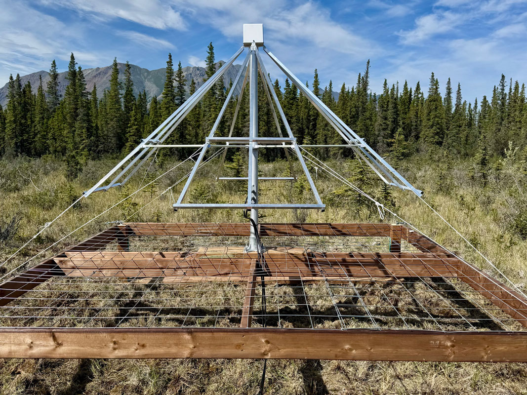
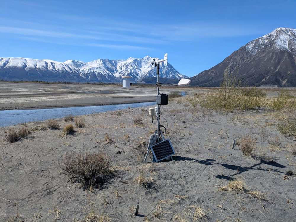
KLRS owns and operates an automated weather station, which was installed in June 2017 and updated in July 2024. The station records a range of meteorological observations which are available for download, including temperature, wind speed and direction, humidity, precipitation, solar and far infrared radiation, and atmospheric pressure. It also meets World Meteorological Organization (WMO) specifications, and is an official WMO Global Cryosphere Watch CryoNet Station. 

In addition, KLRS supports a range of other scientific instruments owned by various research and government groups, including:

  • Hyper-spectral riometer
  • All-sky imager (auroral camera)
  • Sun photometer
  • Air quality monitor
  • Global Navigation Satellite System (GNSS) base station
  • Seismograph
Weather station at KLRS, facing North
The KLRS weather station.

KLRS-Supported Instrumentation

Hyper-Spectral Riometer & All-Sky Imager

Dr. Emma Spanswick and her team from the University of Calgary study near-earth space dynamics, including the aurora (northern lights). They have 2 instruments installed at KLRS, which are part of larger networks of sensors across the north.
 
The all-sky imager (ASI), installed at KLRS in August 2026, is an auroral camera that captures an image of the entire night sky every few seconds. The hyper-spectral riometer (HSR), installed in August 2025, measures cosmic radio waves. During auroral activity, fewer cosmic radio waves reach the HSR antenna, indicating aurora (even during daylight, when it is invisible to the human eye and cameras). Researchers combine data from these instruments with satellite observations to study space weather and improve forecasting.
 
The auroral camera is part of the SMILE ASI project, a network of cameras across northern Canada and Alaska that supports the recently launched SMILE (Solar wind Magnetosphere Ionosphere Link Explorer) satellite. The HSR is part of the Space Weather Adaptive Network (SWAN), which consists of 24 radio sensors across Northern Canada, Alaska, Greenland, and Antarctica. 
 
Data produced by the instruments are openly available:
The night sky (September 8, 2026) above KLRS as captured by the newly installed ASI.
HSR and ASI instruments installed at KLRS in 2025 and 2026, respectively.

Sun Photometer and Air Quality Monitor

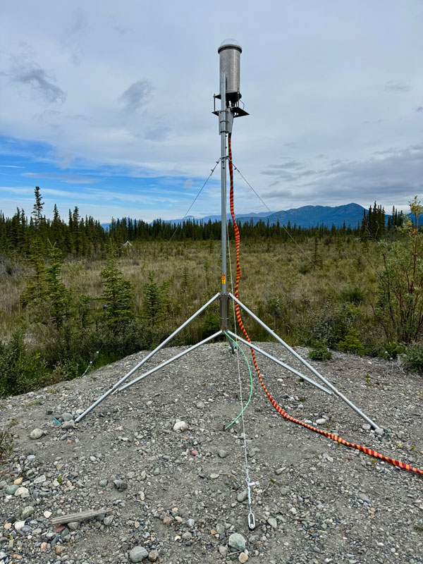
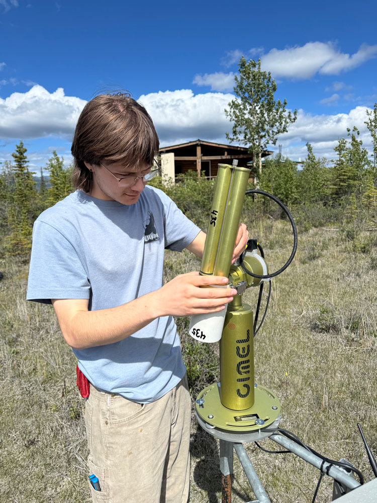
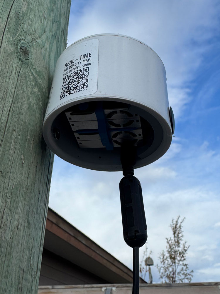
Dr. James King and his team from the Laboratoire d'Érosion Éolienne - Wind Erosion Lab (LEE) at Université de Montréal study aeolian geomorphology, including dust storms in the Ä’äy Chù Valley. They have several monitoring stations in the valley, which transmit data to a computer at KLRS via long-range wireless radio technology. KLRS also hosts their CIMEL sun photometer and PurpleAir air quality monitor.

Learn more about the project and access real-time data from the instruments:

student working on the sun photometer
Summer student Harrison Giesbrecht maintaining the CIMEL sun photometer (first image). PurpleAir air quality monitor installed at KLRS (second image). Weather station and Optical Particle Sensor (OPC) and Plantower (PMS) for particle counts and size measurements; installed up the valley from KLRS (third image). These instruments are operated by Dr King and his team at Université de Montréal.

Global Navigation Satellite System Base Station

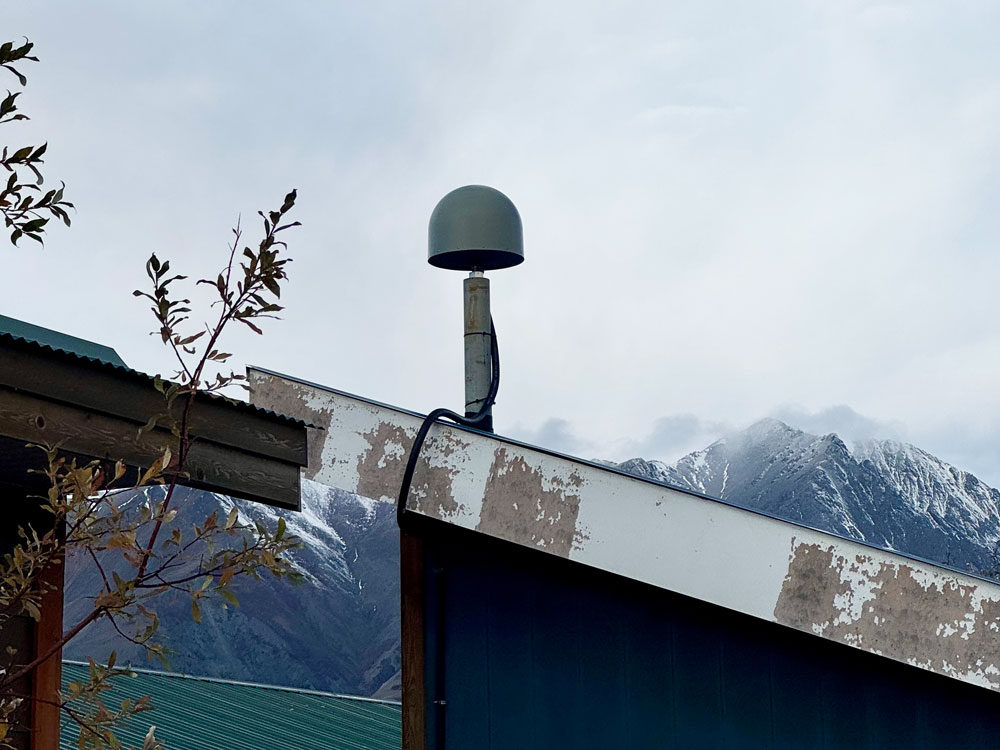
KLRS hosts a Trimble NetR9 GNSS (Global Navigation Satellite System) Reference Receiver, which pushes GNSS (high-accuracy GPS) data to the Canadian Geodetic Survey (CGS) at Natural Resources Canada (NRCan). The data can be used by researchers to study ground deformation or improve the accuracy of their field data. The 30 second daily KLRS GNSS data can be accessed from NRCan.

Antenna attached to a roof-top
Roof-top antenna for the Trimble NetR9 GNSS receiver installed at KLRS.

Seismograph

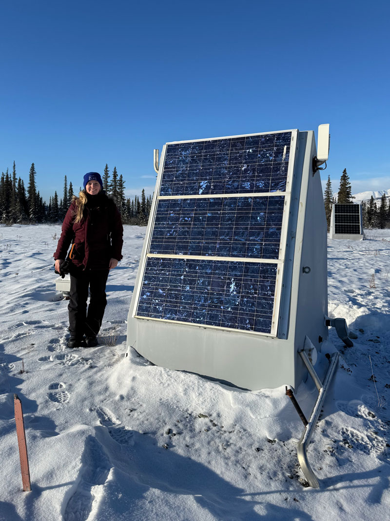
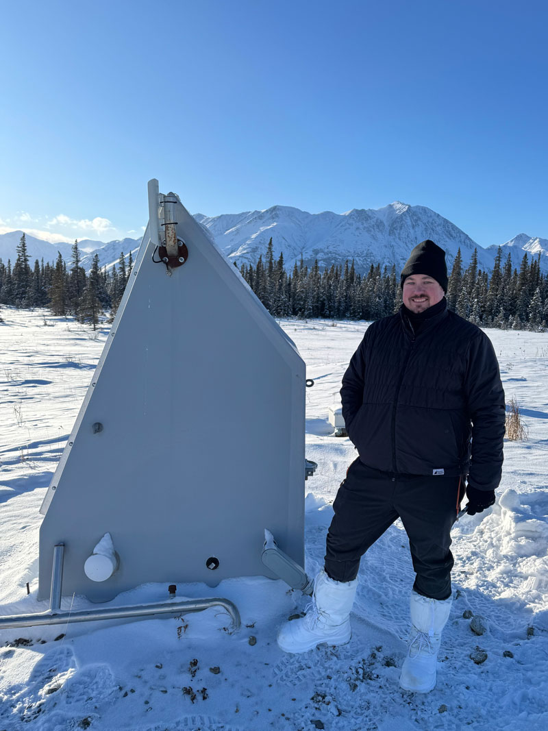
The EarthScope seismograph at KLRS measures ground displacement to detect earthquakes. The data is received by the Geological Survey of Canada (GSC) at NRCan, and sent to Earthscope’s Data Management Centre where the time series and time series metadata can be accessed in a variety of ways.

NRCan also has an outreach program called SchoolShake, which displays the real time data and past earthquake data in an accessible format.

Geologist/Station Manager Kim Hatcher (KLRS) and Seismologist Andrew Schaeffer (GSC) downloading data from the seismograph in March 2026.
linkedin facebook pinterest youtube rss twitter instagram facebook-blank rss-blank linkedin-blank pinterest youtube twitter instagram